
Analysis Says Indiana Redistricting Maps Among Worst Partisan Bias In Country
One political scientist’s analysis of the proposed Indiana House redistricting map says it’s just as skewed towards Republicans as the map drawn 10 years ago – making it one of the most partisan maps in the country over the last 50 years.
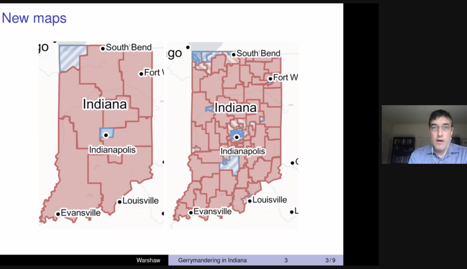
That same analysis says the proposed Congressional map is even worse than the districts Hoosiers have lived under for the past decade.
George Washington University political scientist Christopher Warshaw said, generally, Hoosier Republicans receive at least 56 percent of the statewide vote. Yet his analysis of the proposed House and Congressional maps shows Republicans will likely hold nearly 70 percent of the seats, if not more.
“At the end of the day, this is one of the most extreme gerrymanders in history,” Warshaw said. “And even though it could’ve been more extreme, that really doesn’t take away from the extremity of this plan.”
READ MORE: Redistricting 101: Who Draws Indiana’s Legislative District Maps, And How
Join the conversation and sign up for the Indiana Two-Way. Text “Indiana” to 73224. Your comments and questions in response to our weekly text help us find the answers you need on statewide issues.
Warshaw said fairer maps wouldn’t pack Democrats into a small number of seats in Indianapolis, instead creating more competitive districts across a wider area in central Indiana.
Republicans, though, argue their aim was to create compact districts that keep communities together. And Democrats are highly concentrated in only a few counties.
Warshaw said counties don’t vote, people do.
“We should want a map, as Americans, that represents people fairly,” Warshaw said. “It’s not representing counties fairly, it’s representing people fairly.”
Warshaw’s analysis was funded by Women4Change Indiana, a nonpartisan voter advocacy group.
Contact reporter Brandon at bsmith@ipbs.org or follow him on Twitter at @brandonjsmith5.