
Counties could use outdated flood maps when issuing construction permits under bill
A state Senate bill aims to change which maps local floodplain administrators have to rely on when granting construction permits. Proponents say the state maps are more “restrictive” than the federal ones — leading to confusion and lower property values.
The bill, Senate Bill 242, strikes language from a state law that requires a local floodplain administrator to use the “best floodplain mapping data available” when issuing construction permits.
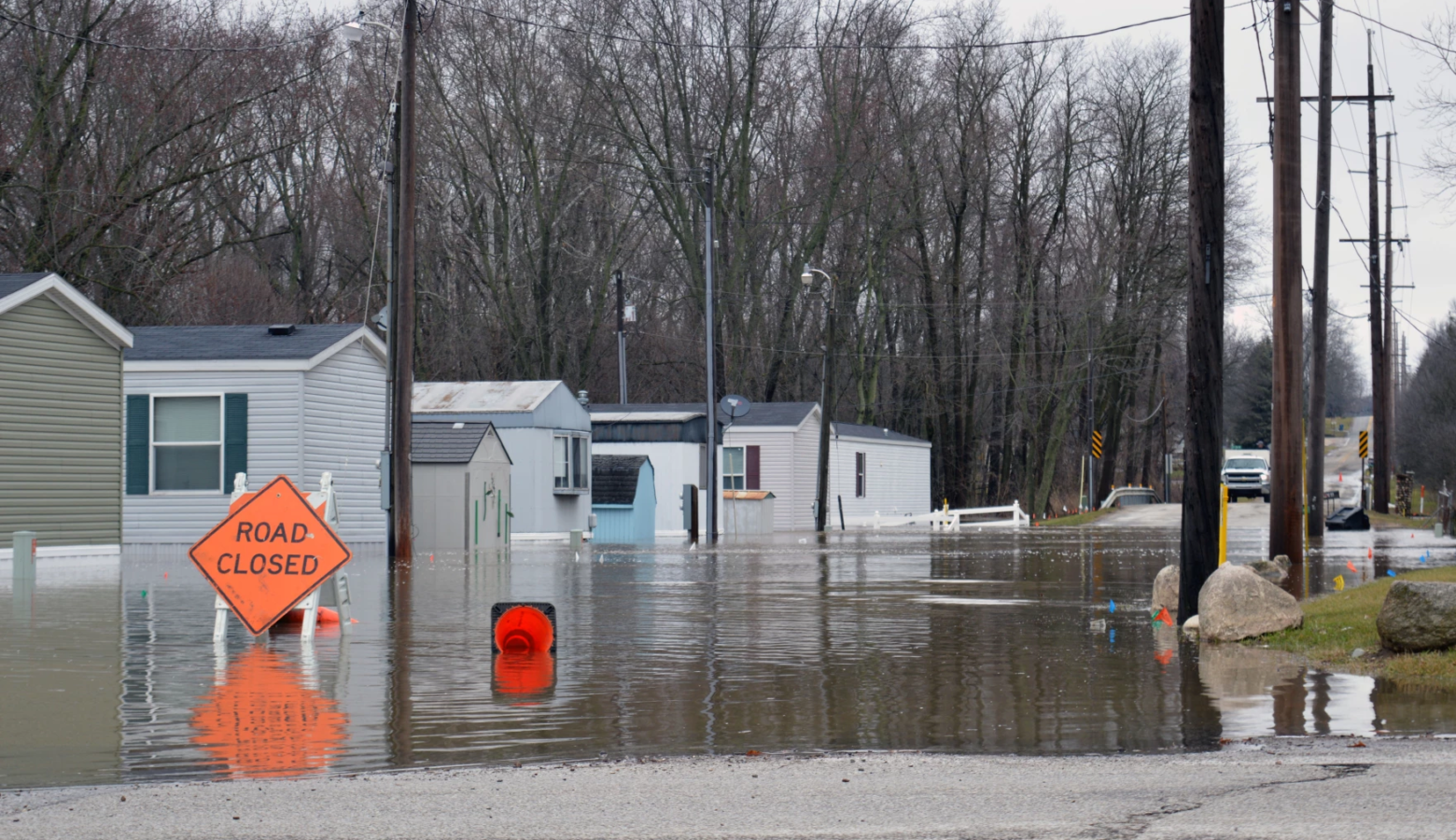
Wayne County resident Lori Garard and her family wanted to build a detached garage, but found out their property was in a fringe flood zone. To comply with the law, they would have to build it several feet higher than their home.
“We would have to borrow property from the neighbors to make the driveway ramp into the seven foot high garage,” Garard said.
FEMA hasn’t yet approved maps on Indiana’s floodplain portal, but the Indiana Department of Natural Resources said it can be used for “general planning, construction and development purposes.” The state maps can’t be used for flood insurance.
While some call the state maps too “restrictive,” others would call them more “protective.” FEMA itself has said its flood maps are outdated. They don’t take the increased rainfall we’ve been having into account. Updated rainfall records are at least three years away.
Join the conversation and sign up for the Indiana Two-Way. Text “Indiana” to 73224. Your comments and questions in response to our weekly text help us find the answers you need on statewide issues and throughout the legislative session.
Some areas of the state haven’t been mapped by FEMA at all, said Jarrod Hahn. He’s president of the Indiana County Surveyor’s Association and sits on the state’s drainage task force.
Hahn remembers the most common things he would hear from flood victims as a first responder.
“‘I didn’t know I was in a flood zone.’ ‘I’m not in a mapped flood zone, how am I flooding?’ ‘I didn’t know my homeowner’s insurance didn’t cover this.’ And the last one was, ‘We lost everything,'” he said.
Instead of passing the bill, groups opposed to it suggest better educating local floodplain administrators and informing the public when new state flood maps come out. They also want the state drainage task force to finish its work first.
Because of local ordinances, some floodplain administrators would still be required to check the state’s maps before issuing permits — even if the bill becomes law. It passed out of committee and now heads to the full Senate for consideration.
Contact Rebecca Thiele at rthiele@iu.edu or follow her on Twitter at @beckythiele.