Indiana To Create Color-Coded COVID-19 Map To Help Guide School Decisions

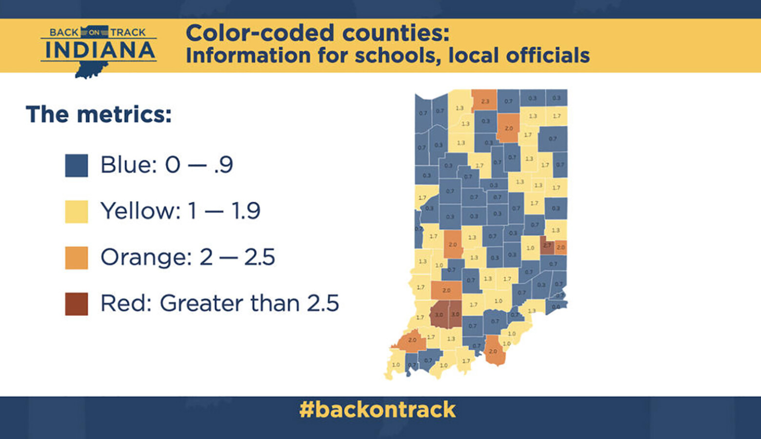
The Indiana State Department of Health will launch a map – color-coded based on COVID-19 metrics – that can help guide decision-making at local schools and governments.
State officials have long resisted setting specific parameters for when local schools should open to in-person instruction or shut back down. But State Health Commissioner Dr. Kris Box said the new guidance comes out of repeated pleas for direction.
Each county will have a color – blue, yellow, orange or red – that indicates severity of COVID-19’s spread. It’s based on a formula of the number of new cases per 100,000 residents, the positivity rate and recent change in that rate.
Join the conversation and sign up for the Indiana 2020 Two-Way. Text “elections” to 73224. Your comments and questions in response to our weekly text help us find the answers you need on COVID-19 and the 2020 election.
Box said with each color comes suggestions for schools. Yellow would indicate moderate community spread of the virus. And the state suggests schools should increase vigilance around mask-wearing, social distancing and hand-washing and consider limiting attendance at athletic events to parents and close family.
“A county in orange would be experiencing moderate to high community spread,” Box said. “In this case, the recommendations include grade schools continue in-person and that a hybrid learning approach be considered for middle and high school students.”
In red counties, the state suggests middle and high schools move to virtual learning and canceling assemblies and extra-curricular activities.
The map will go live next week and be updated every Wednesday.
Contact reporter Brandon at bsmith@ipbs.org or follow him on Twitter at @brandonjsmith5.


