Indiana Republicans Release State House, Congressional District Maps

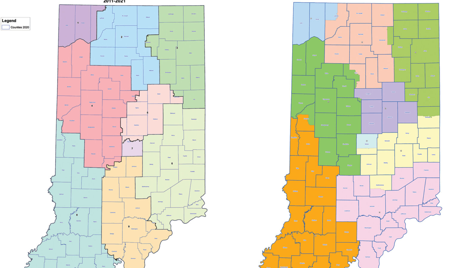
Hoosiers have their first look at who their new state House and Congressional representatives will be. Indiana Republicans released the state House and Congressional redistricting maps Tuesday.
House Republicans said the new maps are more compact than the ones they drew 10 years ago. They point out that fewer counties and townships are split between multiple state House districts.
Join the conversation and sign up for the Indiana Two-Way. Text “Indiana” to 73224. Your comments and questions in response to our weekly text help us find the answers you need on statewide issues.
In a statement, House Speaker Todd Huston (R-Fishers) said the new maps follow all legal guidelines and worked to keep communities of interest together.
But beyond emailed statements from leadership, Republicans didn’t provide other, key information – like, for instance, how many new House districts don’t have an incumbent lawmaker in them. And how many districts have multiple existing lawmakers drawn into them, something that happens every redistricting cycle.
For the last 10 years, Indiana’s Congressional map produced seven Republican districts and two Democratic ones. That’s likely unchanged in the new map – although District 5, in central Indiana, appears to be redrawn by the GOP to make it less competitive and more solidly Republican.
In a statement, House Democratic Leader Phil GiaQuinta (D-Fort Wayne) said his caucus is still evaluating the maps. But he said because House Republicans had the help of “high-priced D.C. consultants,” the district lines will favor the Indiana GOP and not voters.
Hoosiers will get a chance to publicly voice their opinions about the maps at Statehouse hearings Wednesday and Thursday.
Contact reporter Brandon at bsmith@ipbs.org or follow him on Twitter at @brandonjsmith5.

